Monday, April 29, 2024

A Call from the Desert People's Past: The Pictograph Trail at Anza Borrego State Park

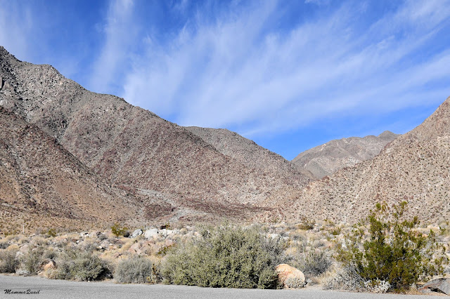
Desert View from the cliff edge at the end of trail


Date: November 23, 2023
Place: Anza Borrego State Park, Borrego Springs, California
Coordinates: 33.020200, -116.360039
Length: 2.8 miles 
Level: easy
 
The pictograph trail was recommended to us at the Anza Borrego State Park visitor center in the morning before we went hiking at Palm Canyon. After our lunch we drove south to the trailhead of the Pictograph Trail. The way there included driving a good distance on a dirt road which was mostly ok but very sandy. It went through a primitive campground that was partially occupied. The parking area was fairly small, with parking 'stalls' roughly formed by previously parked cars in between the creosote bushes and the boulders that were strewn around.
At the trailhead

There were two other cars in the area near one of them were people who looked like they were about to go on the trail. They must have changed their minds while we were getting ready however, because by the time we were ready to set out they went back into their car and drove off.
Our hike as captured by my GPS

The trail led us directly into the boulders, meandering between and around them. I enjoyed seeing the lovely rock garden that included desert bushes and cacti, all looking plump and healthy.
Rock Horn Cholla, Cylindropuntia acanthocarpa

The afternoon sun was already pretty low and the north-facing slopes were dark. The lighting was fine for close up shots and all of my broad view shots have an end of day feel to them. 

We quickly crossed the pass leading to the wash where the pictographs rock was. At the pass - the highest part of this trail, grew many nice looking juniper bushes. 
California Juniper, Juniperus californica

The junipers were laden with pale berries - it was a good year for them. These berries are the staple food of many desert animals, from birds to coyotes. By eating them, and defecating the seeds somewhere else, these animals take an active part in dispersing the junipers far and wide. 
California Juniper, Juniperus californica

A sole agave inflorescence pole stood sentinel on top of the ridge to our right (south). The agave inflorescence was a silhouette and I was unable to tell if this was an active bloom or an old stalk. 
Desert Agave, Agave deserti

To our left (north) was the well lit south-facing slope of a crumbling rocky hill - a slope I might have enjoyed exploring had I been there on my own with more time on my hands. 

The trail curved south a bit and leveled. We walked through a small flat area below the pass, heading southeast. A larger hill of crumbling rock loomed ahead south of the trail. We had to circumvent it to see what was ahead of us. 

Every step we took around the curve of the hill revealed more sights. The rock garden scenery continued - featuring yucca plants as well. None of the yucca were blooming. 
Mojave Yucca, Yucca schidigera

To my utter surprise however, I did see one ocotillo blooming. Nit the entire plant, no. Only the tip of a single branch. A symbolic bloom of sort. 
Ocotillo, Fouqueieria splendens

The rocky slopes from north and south closed in on the trail once more. There wasn't much of an elevation chance there but the narrowing did give me the sense of walking through a sort of a strait.
Pictograph Trail

Here too the intertwined vegetation and the boulders created a beautiful desert rock garden. It probably looks very lovely when the plants are in bloom, but we were there at the end of fall. 

The moon was rising. I noticed it and pointed it out to my family. It was nearly full, and, nestled in the slopes depression, it looked like a big, white ball that paused in the middle of a downhill roll.

A couple of ravens were frolicking ahead of us. I tried to catch them on camera. In the southwest direction, illuminated from behind, the raven looked like a silhouette art of a horror book.
Common Raven

My chika got a much better image of the ravens after they landed on a boulder further down the trail. They seemed to be very friendly to one another - perhaps a couple or a parent - youth.
Common Raven

Just around the big hill we were circumventing on the north was the pictograph Rock. It was a large, smooth boulder with graphic symbols painted on it in red at eyes level.
Pictograph Rock

We drew near and took some photos. Pappa Quail commented that in a way they looked like modern day grafitti - makes left behind by random passers by who wanted to make a lasting statement. These pictographs however, are centuries old, and the paints that were used to make them were not as easily accessible as modern day art supplies. There was clearly planning and preparation involved in creating these symbols, and very likely that they did have a significant meaning to the area people of that time.
Pictgraphs

These days no one knows what is the meaning if these symbols, not even the contemporary Kumeyaay, to whom these pictographs are sacred to this day.
Pictgraphs

Near the pictograph rock I noticed another, lest conspicuous relic of the indigenous people's life in the area - a grinding rock. It was in grinding rocks such as this that the indigenous people used to process food.
Grinding Stone

There were a number of large juniper bushes behind the pictograph rock and the elder chika identified a bird in one of them and took its photo.
Brewer's Sparrow

We decided to continue past the pictograph rock. The information pamphlet we got at the visitor center had another relics site with more grinding stones marked near the end of the trail and we wanted to see it. The trail wasn't long so we continued walking southeast. 
Trail

A couple of people came from that direction. We nodded to one another, and they walked back to the trailhead while we continued to the trail end. 

Pat the pictograph rock the hills on the sides of the trail were farther apart and once again we were walking through a flat little valley with sandy soil and lots of creosote shrubs. There wasn't much going on in terms of wildlife, not even insects. The pamphlet showed the relics site to be near where the trail entered the hills again, but when we approached we saw nothing of human origin but the trail itself. 

We looked around a a bit but, seeing nothing special, we resumed walking and entered the gap between the hills where the creek and the trail squeezed through. This part turned to be a short high-walled canyon that ended with a dry waterfall drop. 

The canyon but was already dark, but when we reached its edge we were washed by the late afternoon sunlight again. 
Desert Agave, Agave deserti

Carefully, I approached the edge of the cliff and looked at the vast desert view that extended below me. The wash itself continued far below, bone dry, all the way to a distant open flat. Behind the large flat loomed the next mountain range, looking hazy at the end of the day. 

Pappa Quail and the chikas sat down on the rock. I was a bit uneasy, seeing how close my elder chika was to the big drop (I cropped most of her from this photo but left her knee in the lower right corner). When I told her that she replied drily that I was standing much closer to the edge than where she was sitting ...  and she was right. It is more difficult to assess someone else's risk than one's own, especially when that someone else is your child. I took a step back and sat down as well. 

After our little break we got back on our feet and turned about, starting our return to the parking area. Back on the northwest side of the canyon bit I searched again for the grinding stones that were supposed to be there according to the pamphlet, but didn't find them on the second search either. 

Our way back through the flat valley was much quicker. I didn't tame many photos, only here and there of some plants that looked nice, such as this double yucca in the photo below. 
Mojave Yucca, Yucca schidigera

The sun was lower now, and when it reached the top of the ridge on the west I stopped and took some photographs of this pre-sunset sunset. 

A large sand bar was in the middle of the valley. Pappa Quail and the chikas went ahead on the trail while I moved north to the other side of the sand bar. There I was able to catch yet another pre-sunset, and before that, see the cholla cacti glistening in the last of the day's direct sun rays. 
Rock Horn Cholla, Cylindropuntia acanthocarpa and Mojave Yucca, Yucca schidigera

The young chika was waiting for me when I returned to the main trail. She pointed out a large, black beetle, similar to the other beetles we've seen in Anza Borrego so far. 
Beetle

We were walking in the dusky zone now. The pictograph rock looked like a black silhouette now, and the raven sat atop it, a guardian spirit of the native past.

This time we didn't get close to the pictograph rock. Apparently there were other pictographs in the area but, concerned about driving ut in the dark, we simply continued on with our hike. 
Pictograph Rock

As we got through the first narrow area of the path I got to see one more animal - a colorful insect climbing a ranch of a shrub. I didn't stop long enough for a proper identification but it looked like a nymph of a grasshopper. 

It was more illuminated at the top of the first narrow area, and I even caught one sunny spot before it too faded into the dusk. There was a buckwheat plant in bloom, a nice species that I don't recall seeing before. 
Davidson's Buckwheat, Eriogonum davidsonii

The tiny flat between the narrow and the pass was already under dusk too. The top of the pass was illuminated with direct sunlight still, and I rushed ahead to try and get there before that too, would fade.

I reached the top of the pass in time and looked down to to the trailhead area, and to Blair Valley beyond. The entire valley was till in full daylight. We needn't have rushed outside to avoid driving in the dark. That got me thinking about something, but I kept my mouth shut until the very end of the hike.  

Behind us - the moon was already high in the sky, and looked much smaller. The line of direct light was creeping up steadily. I took a deep breath and followed my family down the trail to the parking area.

The creosote bushes were all in fruit - none of them was blooming. I liked the fairy lantern look of the fruiting creosote, especially when the end of day light shone through the small fuzzballs.
Creosote, Larrea tridentata

When we got to the car I finally let my idea out. I suggested that the elder chika would drive us out to the main road. She's been a fine driver on paved road but had very little experience on dirt roads. Hearing my suggestion, the elder chika immediately jumped into the drivers seat. Pappa Quail turned pale, and moved to the back so he won't have to sit next to her. (I did). The younger chika, who had got her license less than half a year ago protested loudly that she wasn't offered to drive ... I pacified her by promising her an off pavement experience in Moab, where we had planned to go for the winter break. We got in the car and enjoyed a very bumpy but joyful ride back to our lodge. On the morrow we would begin our long drive back home. 


Friday, April 26, 2024

What Sheep? Rediscovering Palm Canyon at Anza Borrego State Park

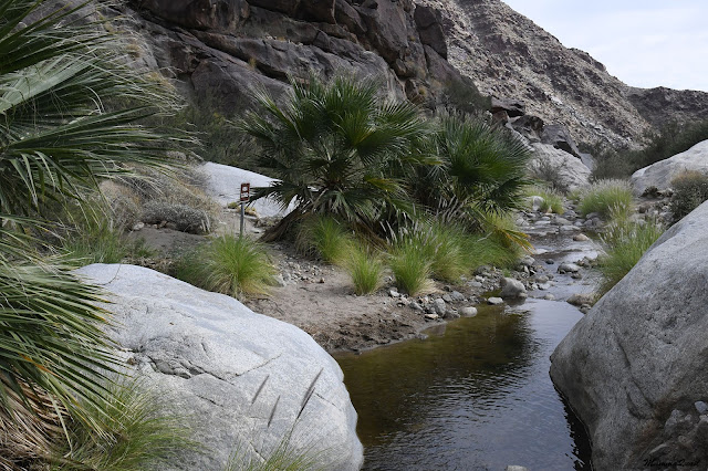
Palm Canyon Oasis


Date: November 23, 2023
Place: Anza Borrego State Park, Borrego Springs, California
Coordinates: 33.270180, -116.419241
Length: 3.5 miles
Level: moderate

On the morning of Thanksgiving Day we headed to the trailhead of Palm Canyon. On the day before we hiked The Slot. This morning we opened the day with a short visit at the Anza Borrego State Park visitor center where we got some information, then drove to the park's main campground where we had stayed in Christmas of 2012 and parked at the day use area where the trailhead was. It was a lovely day - warm but not hot. The sky featured light feather clouds and the desert featured itself - naked and powerful. 
At Palm Canyon Trailhead

Last time we hiked at Palm Canyon, in December of 2012, we set out to look for bighorn sheep. We didn't find the sheep on that hike then, but we've seen them on other occasions since, so this time I weren't anxious to find them, I was ready to relax and enjoy what the desert had to offer.
Our hike as captured by my GPS

Ocotillo is one of the southwest desert unique inhabitants. Beautifully suited for the erratic desert precipitation pattern it spends most of its life bare, photosynthesizing minimally through its stems. When water is available it grows little leaves that are so small they don't really protrude through the thorns. From a distance the ocotillo would look bare still, but fully foliaged, it is much greener than it would otherwise appear. Its most striking transformation the ocotillo does when blooming - it then produces bright red blossoms, and the normally gray-green, well blending in the scenery plant becomes a brilliant advertisement for nectar and pollen goodies, seen far and wide by hummingbirds, sphinx moths, and other pollinators. 
At the end of November, which is when we were there, I expected the ocotillo to be on their most retracted, unfoliaged, semi-dormant stage.The previous summer however, brought some monsoon rains to the desert and many ocotillo responded with sprouting leaves, which they wore still at the time of our visit.
Ocotillo, Fouquieria splensens ssp. splendens

We headed into the trail. The desert mountains loomed ahead of us, serene and dry. Nothing in the scenery suggested that there was water hidden there, an oasis. The creek at the canyon mouth, was dry. 
Almost immediately we had to decide which path to take - the direct trail to the oasis, or the alternative path that followed the southwest side of the wider part of the canyon. We chose to take the alternative route and return by the main trail.

We weren't anxious to see bighorn sheep on this hike, but we did hope to see them, as well as other wildlife. Naturally, we were all very excited when a roadrunner presented itself right at the beginning of our hike.
Greater Roadrunner

I was also happy to see a bit of bloom here and there. It was nothing like the mega bloom I saw in Anza Borrego last January, but I loved seeing every brave little flower along the path.
Windmills, Allionia incarnata var. incarnata

The first part of the alternative trail was level and easy. Generally following the path of the wash it stretches on the higher part of the creek bed, cutting through the wide part of the wash before it encloses into a canyon. 

The young chika pointed out the ants for me to look at. We've seen some insects on this hike, and by far and wide the most numerous of them were the harvest ants.

Little by little the trail shifted upward and we were ascending the southern side slope. It wasn't a steep climb, and we walked at a good pace. I was bringing up the rear, pausing every now and then to check out plants of interesting rocks.
Desert Trumpet, Eriogonum inflatum

A mass of large, red boulders loomed ahead of us. The boulders seemed to be blocking the path but when we approached we saw that the trail ascended around and between the boulders. 
 
For small wildlife these boulders were the perfect home and hiding place. Little squirrels feel secure enough to pose openly atop of the boulder, assured that they could dart instantly under cover at the first sign of threat. 
White-tailed Antelope Squirrel

Birds too find shelter in these rocks, and one bird that was spotted by my family birders, the rock wren, has this habitat mirrors in its name.  
Rock Wren

At the top of the ascend I turned and looked back. The climb wasn't hard and up to the boulders it was hardly noticeable that we were gaining elevation, so it surprised me to see how high we were over the campground area where we started our hike. 

There were more wildflowers along the trail. Not many, but certainly many more than I expected to see at this time of year, especially high above the water source. It was interesting that each flowering shrub had only a single or very few flowers, like it was doing it without much enthusiasm. 
Desert Mallow, Sphaeralcea ambigua

I looked up a side tributary wash. It was completely dry and there was no sign of any oasis up the short wash.  
Side Wash

The cacti weren't blooming and I didn't expected them to, not in November. They did look happy, well watered though. I expect this spring there is a major cacti bloom in Anza Borrego. 
Beavertail Cactus, Opuntia sp.

The trail descended mildly towards the creek below. The creek was higher now so we needn't have descended much. The trail was adorned by happy and healthy looking cacti all the way down. A happy and healthy looking sparrow was perched on one cholla cactus, posing for Pappa Quail and theh elder chika. 
Black-throated Sparrow

We reached the creek and the main trail. Logs marked  the trail's boundary, blocking the access to the water at that spot. The log was a perfect place for a fence lizard to sun itself. 
Western Fence Lizard

It was also the first spot on our hike where we saw the flow of the creek, the year-round running creek at Borrego Palm Canyon, that is the lifeline of Borrego Springs. 

From that place there was only one trail leading to the Palm Canyon oasis. At first it was wide, flat, and very comfortable. We picked up our pace, heading northwest towards the oasis.
Palm Canyon Trail

Near the water the cacti made way to other, less prickly plants, such as willow trees and the Emory's daisy, which I already knew well from previous visits at Anza Borrego and other California deserts. 
Emory Rock Daisy, Perityle emoryi

Down at the canyon where the creek had cut through the rock we could see the exposed layers deposited by the ancient sea that used to be here millions of years ago. At the place we saw, the layers were vertical. They sediments weren't deposited in that way of course. It was subsequent geological forces which created these mountains moved and twisted these rocks to their current formation.

We passed another, longer side tributary wash on our left. I looked into it but there too I saw no signs of any water and no oasis.
Side Wash

The Palm Canyon Oasis was visible ahead of us. There was no mistaking in the presence of water there - California fan palms need fresh water, and lots of it, in order to thrive. The size of the palm grove was evident of exactly that - lots of fresh water.

Nearing the oasis the trail became a bit more challenging. It crossed to the northeast side of the creek and from there it was a matter of going around and over large boulders and bushes.

We came down to and through the creek a couple of time on our way. It was lovely seeing the beautiful, healthy looking palms growing right from the water. The dry, old branches created a thick, protective blanket around the palm's trunk. This layer, which is always removed from palms in city landscaping, provides shelter to many wildlife species. The shelter, and also the palms' tiny and sweet date-like berries make the California fan palm a keystone species in the California desert ecology. If these palm disappear, so will the animals that depend on them.
California Fan Palm, Washingtonia filifera

Palm Canyon Creek was still flowing late in November, fed by springs. The flow was very gentle, and noticeable only in places where the water moved through narrow rock straits and dropped down little rock ledges. In wider areas the creek formed calm pools with mirror-perfect reflections.
Reflection

The palms weren't the only trees in the oasis. All along the running part of the creek were arroyo willows, and up by the oasis I saw other water-loving trees such as the cottonwood poplar. 
Fremont Cottonwood, Populus fremontii

As expected, the vegetation got much thicker the closer we got to the oasis. Anna's hummingbirds flew around us, their wings creating the low pitch buzz after which these tiny birds were named. Occasionally these busy birds would sit and pose for the camera.
Anna's Hummingbird

Hummingbirds are suited for drinking nectar from wildflowers but they also hunt for bugs. This is good because this way they don't have to rely on the leaner menu of fall wildflowers.
Wirelettuce, Stephanomeria pauciflora

Once again the trail ascended, this time on the northeast side of the creek. We didn't climb much, just enough to circumvent a pile of large boulders. There were a couple of places where I had to use my hands to climb a ledge. Cushion-like brittle bushes grew in between the boulders. None of them were blooming, but they looked lovely nonetheless.
Brittlebush, Encelia farinosa var. farinosa

We reached the main palm grove and immediately I saw a big change since the last time we were there. In the winter of 2012 the oasis was a thicket of health palms, all with their thick skirts of dry branches. We could go down and sit by the water,and listen to the multitude of birds that hid in the palms. It was there that we had met another family and connected with them for the rest of that trip and after that too, since like us, they had traveled from the Bay Area. Now the palms stood charred and naked, stripped from their skirts by a fire that apparently was ignited by people. It was no longer permitted to go down to the water, and it was clear why.
California Fan Palm, Washingtonia filifera

We could go a bit further through a narrow and low boulder tunnel, and there we sat down for a break and to observe the oasis from a safe (for the trees) distance above.

Information posts told the story of the native people who lived in this place and relied on pretty much any part of the fan palm for their living. They however, knew how to protect and manage their living area, for their existence depended on it.
Beetle

Where we sat down was a small space, and when other hikers came up and through the boulder tunnel we finished our break and started our way back down.
Desert Lavender, Condea emoryi

I looked up the canyon. There was no evidence of any other oasis, though later I found out that there was another, smaller one behind the curve of the canyon. There was no obvious trail leading upstream but it was clear that people have been going there, scrambling over the rocks and boulders. We weren't going to go there, at least not on this visit.
View up Palm Canyon northwest of the oasis

While we were at the oasis the clouds had gathered. Not thick clouds- we didn't anticipate any rain, but it was enough to darken the view down the canyon. 
Palm Canyon, view downstream

Once again we scrambled through the rocks and boulders until we reached down to the water. There, the palms were younger, and certainly healthy. I was glad that the habitat had still thriving areas for the wildlife.
Palm Canyon Creek

On our way back we took the direct trail straight down the canyon. The trail was wide and comfortable to walk.
Palm Canyon Trail

A good distance from the oasis I saw another tree that seemed to do well in Palm Canyon. It grew far away from the competitive area that was won by the cottonwood and the fan palms. I didn't identify the species of that tree, and there were only a few of them in that place.

We came upon a trail junction where another trail split off to the east into the desert wilderness. Right at the junction were a few wasps on the ground, eagerly tasting something from the rocks, perhaps some minerals? The wasps didn't show any interest in us but elder chika took the photo from a safe distance.

Down the canyon I spotted some chuparosa bushes. In season, these bushes bloom looks like a brilliant red coat on the plant, and hummingbirds hover around them. Now seeing just this one branch blooming pleased me greatly.
Chuparosa, Justicia californica

Here and there we could see the water flow as the trail neared the creek. Each time the flow looked thinner and thinner, until it reduced to small and stagnant water holes.

Closer to the canyon mouth the trail narrowed and curved around large rocks, rounded by eons of floods pushing and polishing them. Some of these rocks were really pretty.

We were back in the dry area of the canyon where the only greenery was of the creosote bushes and of the tiny leaves of the ocotillo that received a good drink last summer.

The hummingbirds were fine in the dry area as well. They had enough chuparosa flowers and insects to live on.
Anna's Hummingbird

The canyon opened up and for some distance the trail merged with the creek bed, which was completely dry here. The clouds were still gathered above but the sun was poking through a large blue patch in between them.

For the rest of the trail I watched Pappa Quail and the elder chika marching ahead, while I walked slowly with the younger chika, chatting and enjoying the beautiful surrounding.

At the trailhead there is a small, man made pond, which is a sanctuary for the rare and endangered desert pupfish. Pupfish are ancient survivors from the immemorial time in which the area was covered with water. Now they remain in the few ponds and water holes left in the desert, like islands remnant of another world.

I saw the fish, but I was unable to take any descent photo of them - they were well hidden within the rushes. I settled on photographing the many honey bees that came to drink from the pond.
Honey Bees

We didn't see any bighorn sheep on this hike but I loved it, regardless. Palm Canyon and The Slot (which we hiked the day before) were second time hikes for us. Our next hike later today would be to Pictograph Canyon, which would be a first time hike for us. I was excited.